
22September
A locally produced movie-drama about life as a NUST student surrounded by notorious classmates an
Read more on the general application process at the Namibia University of Science and Technology.
The Prospectus / Yearbook for the Faculty of Engineering and Built Environment is valid for 2024 only. Curricula and syllabi may be amended for 2025
The Faculty of Engineering and the Built Environment is a 120+ full-time tenure track faculty, fueling groundbreaking research, growing and modernizing its broad and deep technical foundation and skill training. The faculty consists of 2 schools with a combination of 4 academic departments (consisting of 24 Undergraduate programmes and 22 postgraduate programmes), 4 research institutes and a bridging programme (InSTEM).
The Departments are: Department of Civil, Mining and Process Engineering (DCMPE); Department of Mechanical, Industrial and Electrical Engineering (DMIEE); Department of Architecture, Planning and Construction (DAPC); and Department of Land and Spatial Sciences (DLSS).
The Institutes are: Material Testing Institute (MTI); Institute for Land, Livelihoods and Housing (ILLH); Namibia Energy Institute (NEI); and the Centre FOR Mining and Mineral Beneficiation Beneficiation (CEMMB).
Our students get excellent preparation with an emphasis on interdisciplinarity, independent learning ability, innovation, and design. Our professional degree programmes recognises the reality that the modern engineering professional needs to be multi-skilled, therefore, equipping our students to confidently grab their space in an ever-evolving industry and inscribe an indelible contribution to the engineering profession by further expanding opportunities reaching across global borders and diverse disciplines to address the pressing complex challenges of our time, consequently, creating a strong and resilient future.
Our rich alumni network that continues to establish outstanding records of achievement not only in technical fields but also in academia, business, government, and as leaders in their community is testimony to this assertion. In essence, we offer a perfect platform for students to thrive.
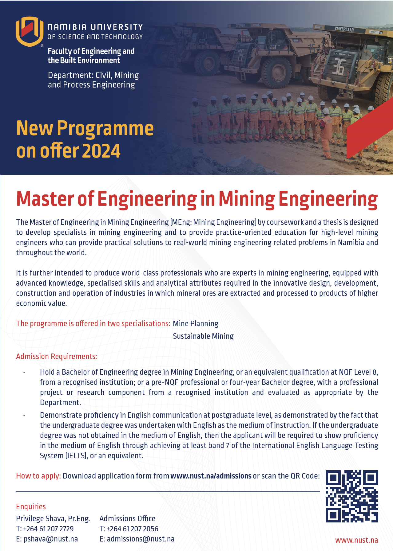
The Master of Engineering in Mining Engineering (MEng: Mining Engineering) by coursework and a thesis is designed to develop specialists in mining engineering and to provide practice-oriented education for high-level mining engineers who can provide practical solutions to real-world mining engineering related problems in Namibia and throughout the world.
It is further intended to produce world-class professionals who are experts in mining engineering, equipped with advanced knowledge, specialised skills and analytical attributes required in the innovative design, development, construction and operation of industries in which mineral ores are extracted and processed to products of higher economic value.
The programme is offered in two specialisations:


Vision
A premier technological university known for knowledge creation, innovation, and entrepreneurship.
Mission
An engaged and responsive university, meeting the needs of stakeholders through excellent education, applied research, innovation and service.